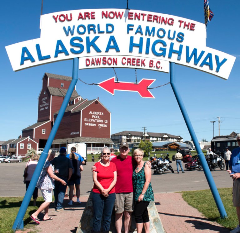
We arrived in Dawson Creek, BC for a two night stay to allow us a full day to explore this small town that enjoys the status of being Mile 0 on the Alaska Highway. Our tour had arranged for the visit of a representative from the town’s tourism board to come to the campground and give us a slideshow presentation about the history of Dawson Creek and the Alaska Highway. Afterwards, we headed into town to have our picture taken as a group (and as individuals) at the iconic Mile 0 sign. We all received collector pins for the highway and a certificate recognizing our start on this famous route.
I will not attempt to give you a history lesson with this blog but for those of you who may not be aware (and I wasn’t before I read James Michener’s book Alaska) the Alaska Highway was built shortly after Pearl Harbor to provide a way to move supplies and troops to protect the United States interests in the far reaches of Alaska. It actually is a fascinating story and I would encourage you to read about it here. Some interesting statistics, however, include:
- The highway runs from Dawson Creek, BC to Fairbanks, AK – 1,523 miles
- 11,000 U.S. troops and 16,000 American and Canadian civilians built the road
- 133 bridges constructed
- 8,000 + culverts installed
- It took only 8 months, 12 days to construct – quite an engineering feat!

Celebrating its 75th year, the highway continues to provide the only east to west route from Dawson Creek to Alaska and is traveled not by troops but by tourists like us eager to visit the Great White North!
Alaska Highway aka the Alcan
Our first day driving the Alcan would take us from Dawson Creek to Fort Nelson – a 284 mile trip going mostly north. We found the scenery to be relatively flat and dominated by trees, trees and more trees (though there were elevation changes and grades of up to 10%). It was a stretch of highway dominated by large trucks servicing the area’s gas and oil production facilities. The upside of this industry’s presence in the area is that for the bulk of this travel day the road was well-maintained and we had good cell service which, was not expected and probably will not be true for much of the road. The downside is that the trucks going in the opposite direction tend to throw up gravel and we took a direct hit that put a crack in the windshield within 100 miles of setting out! Eek, we aren’t even in Alaska yet!! (Once we made it to our campsite, we learned there were 3 others besides ourselves looking at the options for windshield repair!)
We did encounter one construction delay (we understand the seasons up here are winter and road construction) that held us up about ½ hour. We were the first in the line and the flagwoman told us to feel free to get out and stretch a bit with the added precaution that the area was frequented by bears! Needless to say, we opted to do our stretching on the INSIDE of the RV! Once allowed through, we hit the worst part of this day’s drive. The construction crews had just laid fresh gravel on the road for a stretch of about 10 miles which A) is not really fun to drive on and B) kicks up a lot of gravel and stirs up a lot of dust! At one point, we had to come to a grinding halt because the dust was so thick you couldn’t see in front of you! While I hated it for us, I felt very sorry for the motorcyclists in front of us – they had to have felt sandblasted!
Good news is that all 19 rigs made it safely to our landing spot for the night with stories to tell of the memories made!


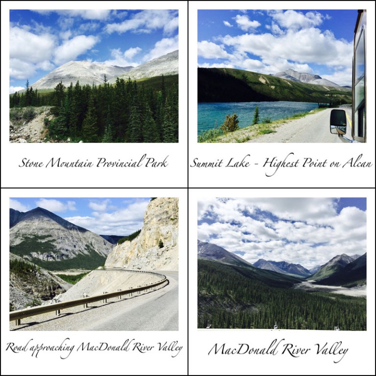
Day two’s drive was a short one of 157 miles from Fort Nelson to Muncho Lake and would include traversing the highest point on the entire length of highway. But, you must bear in mind that while 157 miles on an 8 lane interstate going 70 mph is just a jaunt up the road, on a two lane road navigating mountain passes, winding along rivers, stopping for pics (if the turnout is wide enough) and gawking for wildlife, that 157 miles becomes a ½ day’s drive! Fortunately, for us, it was an uneventful one and quite beautiful. Instead of trees upon trees, we saw mountains again and crossed turquoise blue rivers.

We spotted another bear and a small herd of stone sheep alongside of the road.

We found a cute little spot for lunch and enjoyed steaming bowls of beef stew and veggie beef soup. AND, when we arrived at the campsite we found that it sat upon the shores of the lake itself! Our travel meeting this night was around a campfire down by the lake…hard to pay attention to our hosts with a setting like that!


We awoke on day three to rain and chilly weather but were able to break camp between showers and hit the road by 9:00. This is the day that would take us out of British Columbia into the Yukon Territory – pretty exciting! Another short drive of only 164 miles, this trip was punctuated by the number of wildlife we saw. Three bears (but no Goldilocks) and a small herd of bison! Bison are tremendous animals and to see them right out the RV window was amazing. The bear sightings are pretty amazing, too!


The road itself was good – some gravel top to start the day but since it had rained it wasn’t dusty and no frost heaves on this stretch to send us skyward! The RV and Kia are in desperate need of a wash!

Our stop for the night is in Watson Lake, YT. It is most famous for its signpost forest which began during construction of the Alcan in 1942. The original builders of the highway in homage to the hometowns they were missing, erected signs bearing the names of these faraway places. This started a tradition that has been going on since and with over 83,000 signs this “forest” has gotten quite big! We added 2 more to that total with the addition of ours to forever memorialize that we once stood in this remarkable spot!


